
About Our Clickable Species Maps
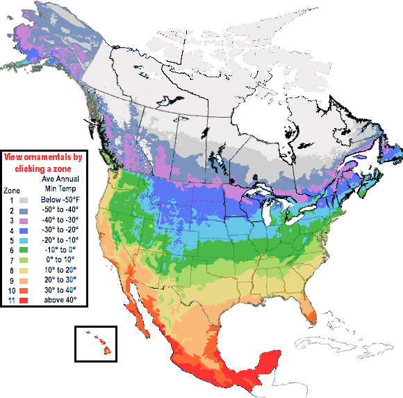
USDA Hardiness Zones
- This USDA plant hardiness zone map is based on USDA Miscellaneous Publication 814, "Plant Hardiness Zone Map," which was revised in 1965 and more recently in 1990.
- Zones represent average annual minimum temperatures, in 10°F increments.
- Ornamentals are species (not varieties) that are commonly planted.
- Clicking on a state generates a listing of native and naturalized species for that state.
- For our purposes, zonal subdivisions in the original map have been combined.
- For the original map, along with additional information, please visit the National Arboretum
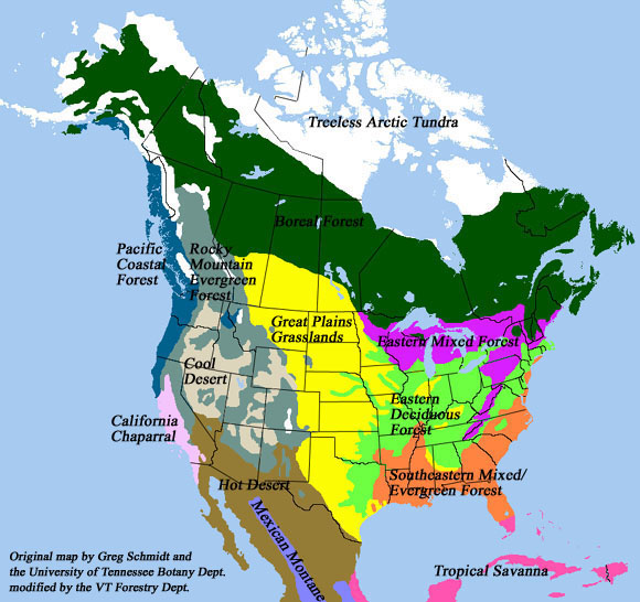
North American Floristic Regions (Biomes)
- This map of North American Floristic Regions was based on work by Greg J. Schmidt with the University of Tennessee Botany Department.
- Further information on the Floristic Regions (and the original map)
- Original map boundaries were based on interpretation of available vegetation/floristic maps such as in Goode's world atlas, Gleason and Cronquist's Plant Geography, and Bailey's ecoregions.
- Map boundaries were adjusted based on forest cover type data available at the National Atlas.
- THIS IS NOT AN EXACT SCIENCE! For example, small populations of Boreal Forest species can be found at High Elevations in the Appalachians. They are not represented on this "painted" map. The intent is to provide GENERAL information, and (hopefully) aid end users with their tree identification needs.
| Last Updated: April 2010 | Contact Us | Photo Use |